Have you ever wanted to see the exact route you had taken when driving to your relatives for the Holidays? Or have you ever had your speed demon of a teenager get a ticket? During a vacation have you ever wanted to Geotag your pictures? Well if so, then the Visiontac VGPS-900 may be just the device for you.
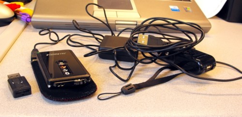
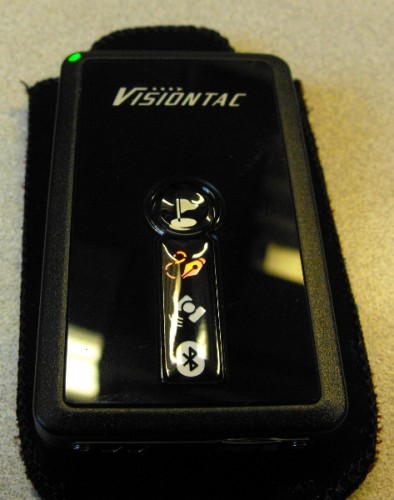
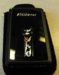
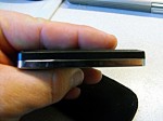
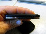
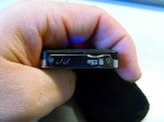
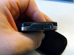
The VGPS-900 is about the size of a zippo lighter, but thinner. The front of the device is dominated by the Point of Interest button followed by three light-up LED indicators. There’s a indicator for the log, one for GPS status and one for Bluetooth. The device’s right hand side device has one button for recording voice memos, on the bottom is the slot for the microSD card and a lanyard, and on the top is the charge port.
Visiontac also includes a AC charger and a DC charger as well. Plus one feature that the DC charger has is it will automatically turn the VGPS-900 on and off when you turn your car off saving battery power as well as a bunch of points being collected while you take your break.
It is very easy to operate. In fact, most of the time, you don’t even need to have it in your hand. Once you turn the device on you don’t need to do anything. Once a fix has been made, the data logger logs a point to a CSV file every second. There are two modes that you can put the VGPS-900 in. Standard mode records date, time, latitude, longitude, Altitude, Speed, Heading and Voice. The Professional mode records all the standard mode records, plust it records the fix mode, VDOP, HDOP and PDOP. The only parameter it doesn’t record is TDOP (DOP means dilution of precision). The lower these numbers are the more accurate the fix is. Professional mode is what I usually left it in as I would like to know if the fix it recorded was a 3D fix. If you are only looking to create 2D tracks, then Standard mode is sufficient.
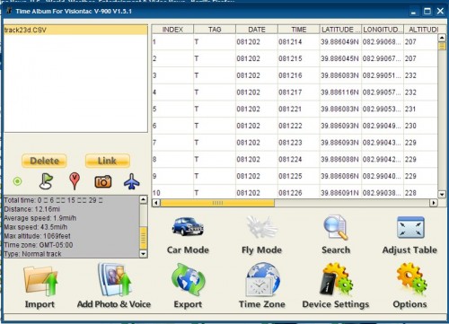
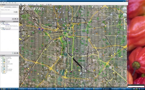
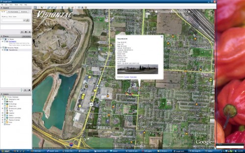
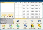
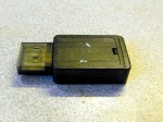
Once the log has been created, you pop your microSD out and put it in a reader. Visiontac includes a tiny one in the box, which you can pop into any Windows, Mac or Linux based machine and run the included Time Album software. Time Album’s job is to take the CSV files and convert them to KML or KMZ files that you can now open in Google earth. Below is a screenshot.
You can download some sample KMZ files that I created here. They open up with Google Earth. (Note: These files are on drop.io and will expire 1 year after the last access. (If I find a better solution, I will update the post)
The 2d Track The 3d Track
If that was all this could do, it would still be a very handy tool. The addition of voice recording and the POI button adds a couple interesting features. First, any time you want to mark a point of interest in the log, just press the button. It will put a push pin in your map once you run it through Time Album and bring it up with Google Earth. The POI button is also used for what Visiontac calls photo positioning. The rest of the world calls this Geotagging. What it does is write the position data to the EXIF tags on the JPG your camera takes. Now there is one caveat with this feature in that your camera needs to be in sync with your computer time wise. With in a few seconds second should suffice. No need to get everything synced exactly. Also when the KMZ file is created by Time Album, it will rescale and add the pictures to the KMZ and a pushpin for the picture will show up instead of a POI. I am still waiting for a GPS to become common in cameras; for now, this is a acceptable alternative. I just wish you didn’t have to press the POI button at the same time. It seems, to me, Time Album should just look for the fix that’s closest to the time stamp of the picture and use that.
One thing I did find is it will even geotag panorama mode pictures. Just click the POI button after you take the last frame in the panorama.
The VGPS-900 also has a voice recording feature. When you add these to your CSV file in Time Album, it will also add a voice note link in the KMZ. Your supposed to be able to click on the link in Google Earth and it play the voice recording but I wasn’t able to get it to work on Linux. The sound quality also has much to be desired. Listen what it sounds like: vox00018
The sound is an 8 bit wav. Good enough for voice notes, but not much else.
Finally, there’s a Spy Mode. This mode is useful for long term tracking. This might be the mode you use to “spy” on your teenager. Holding the voice recording button and the power button until you hear 2 long beeps. The VGPS-900 will then try and get a fix. While it’s getting this fix, the lights are on and the power indicator is blue. Once it has a fix, it will log for 8 seconds and then go to sleep. The battery is stated to last 30 days when in this mode. This would be good for times when your away from a ac outlet and can’t charge.
Battery live on the VGPS-900 is VERY good. Even in regular mode I only ran out of juice once. I can get away with charging once a week with light use. With heavy use, I estimate once every couple days.
The VGPS-900 also has Bluetooth. Even though I couldn’t use it for anything on my enV it paired up just fine. Unfortunately I couldn’t get it working on Linux or Windows XP. Lenovo’s Bluetooth stack on my T60 isn’t very good or even functional for some reason. Anyway theoretically, you could use this with Google Earth Plus or your favorite mapping program on your laptop. You could probably also use this with GPS Drive on Linux as long as you have a constant internet connection for the maps.
One thing I did not get a chance to do with this is uploading of tracks to the Open Street Map Project. Open Street Map has a goal to make the most complete mapset that is ALSO freely available for use in Open Source applications. Most proprietary mapping programs use Navteq for their map data and they pay a pretty penny for it. Open Street Map is freely available for anyone to use. However, they need people to use GPS’s to create tracks of unmapped streets and even hiking trails. The VGPS-900 should ve perfect for this since it uses a CSV format and you can convert the files to the GPX format with GPSBabel. GPX is what the Open Street Map tools need. At the point you have a file ready, you can upload via the Open Street Map websites program called potlatch, or you can use a Java program called JOSM.
Again I haven’t tried this, but theoretically it should work. Visiontac should make a point of sending some of these out to the Open Street Map project to verify this. Then once they test it, they should encourage and advertise that their device works for creating tracks for Open Street Map.
The Visontac VGPS-900 is available at many sites. Semsons has it on sale now for $109.99 and it can also be direct from Visiontac for the same price.
What I liked: Works really well at what it does. Time Album creates KMZ’s that can be emailed to friends. Could be handy for trail running directions and then sending the KMZ to your friends when they need directions from the freeway. You can’t get much better than that! Plus Time Album works on Linux, Mac and Windows XP and probably anything else that supports Suns’s Java and some form of graphical desktop.
What I didn’t like: Almost too small. Funny story….I had it in my pocket when I went to Church and lost it for about 20 minutes. Someone turned it in and gave it to the pastor who held it up in front and asked if someone lost something and if they would come and get it. I walked up to the front with the reddest face!




Great review, Joel! That’s a really cool GPS tool. Might have to put that on my wish list.
Hey Joel, just FYI, i plan on buying one and using it for geotagging, you commented on how you have to push the button to geotag your photos, however, you can use a number of programs to tag photos from the log using the nearest data point just like you mentioned you wished you could do, try robogeo or the gps software you can download from http://www.locr.comif you want a free option (you dont have to use their service to use the software). I still think the point of interest button with voice recording will be handy when travelling though, i have beckpacked a bit and despite taking a photo of something you dont always know what it is when you get back, a voice tag i can take and later put in a caption would fix that